Body
 |
|
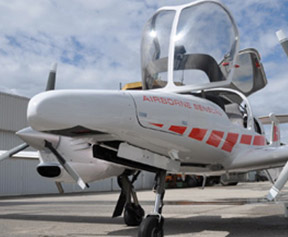
Diamond DA42 MPP |
(RIEGL Laser Measurement Systems: Horn, Austria) -- Airborne laser scanning is a rapid, highly ariegl-fig2ccurate, and efficient method of capturing 3-D data of large areas for various applications (e.g., city modeling, powerline monitoring, large area and flood-plain mapping, and even precise digital terrain modeling. Up to now airborne service providers had to put a lot of time and work into system integration and data acquisition—a major cost factor of the whole surveying mission.
…
Want to continue?
Log in or create a FREE account.
By logging in you agree to receive communication from Quality Digest.
Privacy Policy.
Add new comment